Greyfriars Farm
Introduction
The photograph on this page of Greyfriars Farm by Alan Hunt as part of the Geograph project.
The Geograph project started in 2005 with the aim of publishing, organising and preserving representative images for every square kilometre of Great Britain, Ireland and the Isle of Man.

There are currently over 7.5m images from over 14,400 individuals and you can help contribute to the project by visiting https://www.geograph.org.uk
Greyfriars Farm
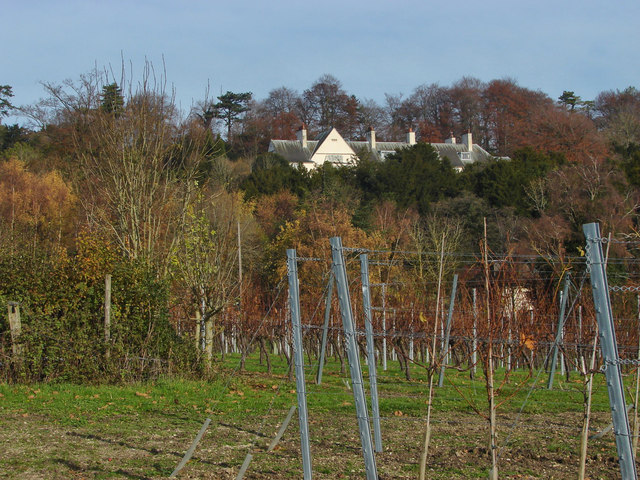
Image: © Alan Hunt Taken: 26 Nov 2013
Greyfriars farm is now run as a vineyard. Greyfriars house can be seen on the hill above the farm. This arts and crafts house was built in 1896 by the architect Charles Voysey.
Images are licensed for reuse under creativecommons.org/licenses/by-sa/2.0
Image Location
Latitude
51.22509
Longitude
-0.648099