The Church of St Bartholomew, Sutton Waldron
Introduction
The photograph on this page of The Church of St Bartholomew, Sutton Waldron by Maigheach-gheal as part of the Geograph project.
The Geograph project started in 2005 with the aim of publishing, organising and preserving representative images for every square kilometre of Great Britain, Ireland and the Isle of Man.

There are currently over 7.5m images from over 14,400 individuals and you can help contribute to the project by visiting https://www.geograph.org.uk
The Church of St Bartholomew, Sutton Waldron
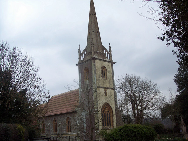
Image: © Maigheach-gheal Taken: 23 Mar 2007
The name Sutton Waldron is broken down as Sutton - South Tun - indicates that in Saxon times it was south of some well known centre which was probably Shaftesbury. Waldron is derived from the name Waleran a huntsman who was given the estate by William the Conqueror. The Church of St Bartholomew is Victorian which replaced an earlier Saxon church, and it was built entirely at the expense of the incumbent, Canon (later Archdeacon) Huxtable and consecrated in 1847.
Images are licensed for reuse under creativecommons.org/licenses/by-sa/2.0
Image Location
Latitude
50.940575
Longitude
-2.197355