St Mary's Church, Queniborough
Introduction
The photograph on this page of St Mary's Church, Queniborough by Alan Murray-Rust as part of the Geograph project.
The Geograph project started in 2005 with the aim of publishing, organising and preserving representative images for every square kilometre of Great Britain, Ireland and the Isle of Man.

There are currently over 7.5m images from over 14,400 individuals and you can help contribute to the project by visiting https://www.geograph.org.uk
St Mary's Church, Queniborough
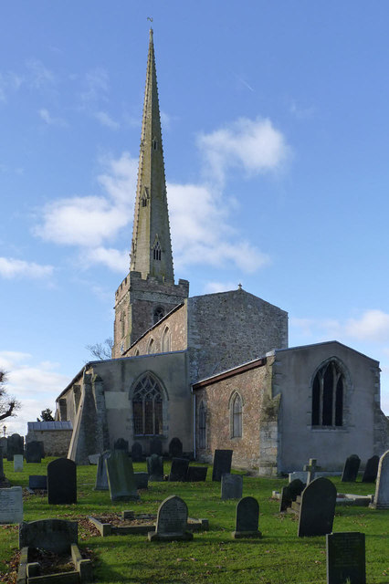
Image: © Alan Murray-Rust Taken: 22 Nov 2013
View from the eastern end of the churchyard. The church dates mainly from the late 13th/early 14th century, and is Listed Grade I.
Images are licensed for reuse under creativecommons.org/licenses/by-sa/2.0
Image Location
Latitude
52.70231
Longitude
-1.038319