Warden Point
Introduction
The photograph on this page of Warden Point by Chris Whippet as part of the Geograph project.
The Geograph project started in 2005 with the aim of publishing, organising and preserving representative images for every square kilometre of Great Britain, Ireland and the Isle of Man.

There are currently over 7.5m images from over 14,400 individuals and you can help contribute to the project by visiting https://www.geograph.org.uk
Warden Point
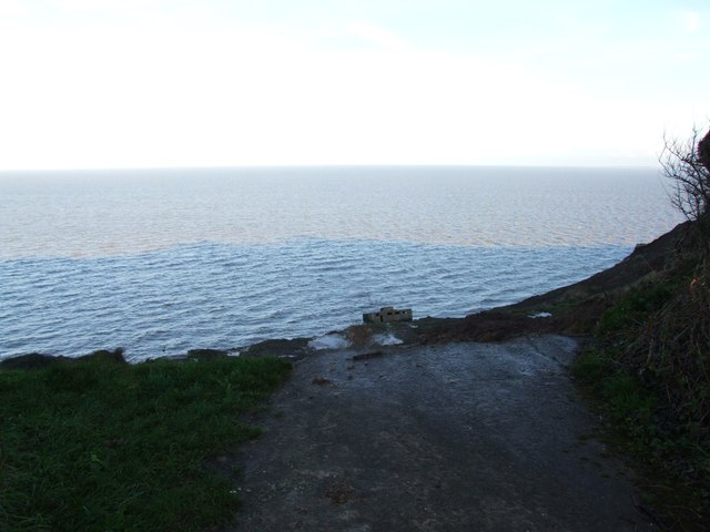
Image: © Chris Whippet Taken: 23 Nov 2013
This picture has been taken at the very end of Warden Road where cliff erosion is slowly reclaiming the area to the sea. The remains of a concrete bunker can be seen on the beach below.
Images are licensed for reuse under creativecommons.org/licenses/by-sa/2.0
Image Location
Latitude
51.415411
Longitude
0.900679