Site of former Llandre station
Introduction
The photograph on this page of Site of former Llandre station by Ben Brooksbank as part of the Geograph project.
The Geograph project started in 2005 with the aim of publishing, organising and preserving representative images for every square kilometre of Great Britain, Ireland and the Isle of Man.

There are currently over 7.5m images from over 14,400 individuals and you can help contribute to the project by visiting https://www.geograph.org.uk
Site of former Llandre station
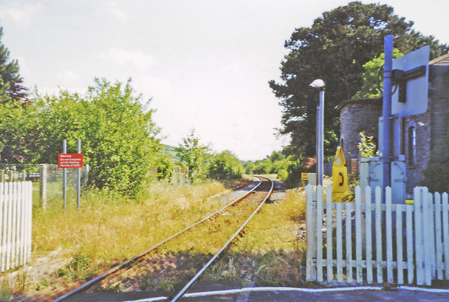
Image: © Ben Brooksbank Taken: 24 Jun 2003
View southward, towards Aberystwyth: ex-Cambrian Railways main line - now somewhat down-at-heel, Aberystwyth - Machynlleth etc. The station (house on the right) was closed 24/6/65. (See also Image]).
Images are licensed for reuse under creativecommons.org/licenses/by-sa/2.0
Image Location
Latitude
52.462504
Longitude
-4.02515