
London Road, Spalding
Introduction
The photograph on this page of London Road, Spalding by Bob Harvey as part of the Geograph project.
The Geograph project started in 2005 with the aim of publishing, organising and preserving representative images for every square kilometre of Great Britain, Ireland and the Isle of Man.

There are currently over 7.5m images from over 14,400 individuals and you can help contribute to the project by visiting https://www.geograph.org.uk
London Road, Spalding
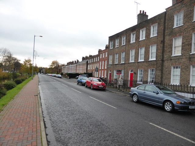
Image: © Bob Harvey Taken: 23 Nov 2013
Georgian ribbon development along the banks of the Welland. This end has the properties on the pavement, so they are almost certainly early Georgian. As you get out of town they are set further back, until quite generous front gardens appear. The individual properties become larger too. Although still unmistakeably Georgian in style the later ones are probably early Victorian. The smaller windows of the 3rd floor are characteristic of the periods, being as they were bedrooms, nurseries, or children's quarters. But here in Spalding the difference is always less marked that in more prosperous towns, suggesting that the larger windows of the ground and first floor are more of an illusion: these houses do not have the huge high ceilings of properties in more fashionable towns.
Images are licensed for reuse under creativecommons.org/licenses/by-sa/2.0
Image Location

Latitude
52.783054
Longitude
-0.151344