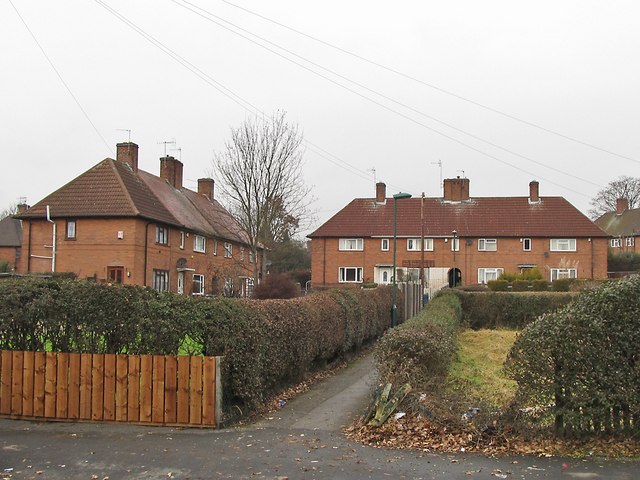
Typical 'twitchell' of Nottingham City Council houses
Introduction
The photograph on this page of Typical 'twitchell' of Nottingham City Council houses by SK53 as part of the Geograph project.
The Geograph project started in 2005 with the aim of publishing, organising and preserving representative images for every square kilometre of Great Britain, Ireland and the Isle of Man.
There are currently over 7.5m images from over 14,400 individuals and you can help contribute to the project by visiting https://www.geograph.org.uk

Image: © SK53 Taken: 4 Jan 2011
Nottingham Borough Council built a huge number of council houses between the 1920s and the early 1950s. The bulk of them were built to a limited number of designs which can be found all over the city. The eight houses here represent one of the commoner designs: a terrace of four houses with a central arch giving access to the back gardens of the central houses. Houses grouped along a pedestrian footway (usually known locally as a twitchell) are also a characteristic feature of the design of the estates where most of this housing was built. Also visible are the original picket fences: usually supplemented, as here, with privet hedges.

