Tottington Methodist Church
Introduction
The photograph on this page of Tottington Methodist Church by Paul Anderson as part of the Geograph project.
The Geograph project started in 2005 with the aim of publishing, organising and preserving representative images for every square kilometre of Great Britain, Ireland and the Isle of Man.

There are currently over 7.5m images from over 14,400 individuals and you can help contribute to the project by visiting https://www.geograph.org.uk
Tottington Methodist Church
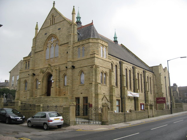
Image: © Paul Anderson Taken: 23 Mar 2007
This Grade II listed building on Market Street closed in August 2004 for the carrying out of a major scheme of reconstruction. For over 100 years there has been a church building on this site. Both buildings had suffered from the ravages of time and in particular the church building had at least a fifty year history of dry rot and had suffered from structural decay and water pressure heave to the lower floor. Following completion of the scheme, the church reopened for worship in August 2005. For more information about Tottington Methodist Church click on http://www.tottimeths.org.uk/home.html
Images are licensed for reuse under creativecommons.org/licenses/by-sa/2.0
Image Location
Latitude
53.613782
Longitude
-2.341122