Martyrs memorial (names)
Introduction
The photograph on this page of Martyrs memorial (names) by E Gammie as part of the Geograph project.
The Geograph project started in 2005 with the aim of publishing, organising and preserving representative images for every square kilometre of Great Britain, Ireland and the Isle of Man.

There are currently over 7.5m images from over 14,400 individuals and you can help contribute to the project by visiting https://www.geograph.org.uk
Martyrs memorial (names)
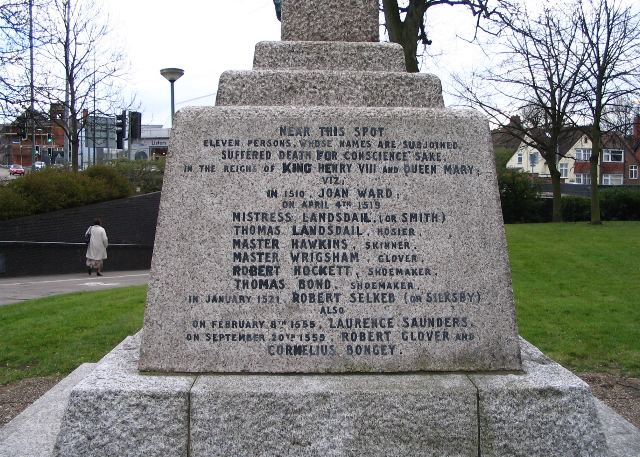
Image: © E Gammie Taken: 20 Mar 2007
The north side of the Martyrs memorial ( Image ) showing the names of those commemorated. The inscription is cut and drilled with lead into the Cornish granite of the monument. To the left the ramp leads down to the subways to Mile Lane (visible on far left), Quinton Road or Park Road (houses on right).
Images are licensed for reuse under creativecommons.org/licenses/by-sa/2.0
Image Location


Leaflet Map data © OpenStreetMap
Latitude
52.403127
Longitude
-1.508143