Field at Arkleston
Introduction
The photograph on this page of Field at Arkleston by Lairich Rig as part of the Geograph project.
The Geograph project started in 2005 with the aim of publishing, organising and preserving representative images for every square kilometre of Great Britain, Ireland and the Isle of Man.

There are currently over 7.5m images from over 14,400 individuals and you can help contribute to the project by visiting https://www.geograph.org.uk
Field at Arkleston
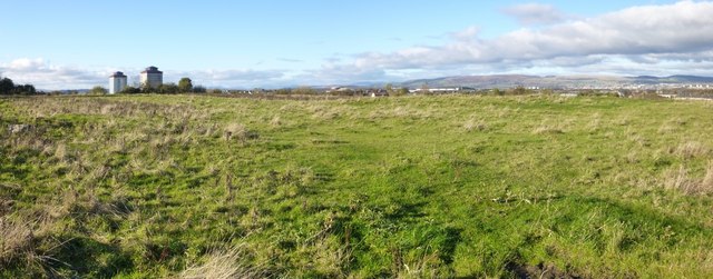
Image: © Lairich Rig Taken: 4 Nov 2013
See Image for more on this area. The present picture was taken from a field gate beside the road junction. The high flats in the background are two of three that stand alongside Image in the Gallowhill area: Image is on the left, and Image is on the right, hiding the third building (Image) from view. The field shown in the present picture is just to the north of the area shown in Image It formerly contained an old quarry pit (see Image and the first link in the previous paragraph), but that pit has been filled in, and the ground levelled. There used to be a small building, a powder magazine, nearby: Image
Images are licensed for reuse under creativecommons.org/licenses/by-sa/2.0
Image Location
Latitude
55.858041
Longitude
-4.397111