The Gregory, a pub converted to student flats
Introduction
The photograph on this page of The Gregory, a pub converted to student flats by SK53 as part of the Geograph project.
The Geograph project started in 2005 with the aim of publishing, organising and preserving representative images for every square kilometre of Great Britain, Ireland and the Isle of Man.

There are currently over 7.5m images from over 14,400 individuals and you can help contribute to the project by visiting https://www.geograph.org.uk
The Gregory, a pub converted to student flats
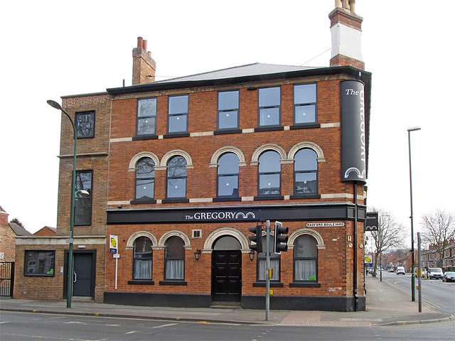
Image: © SK53 Taken: 8 Apr 2013
The Gregory was one of the core components of this junction: known as "'ation Corner" after the four buildings surrounding the junction: a church (SalvATION), a school (EducATION), a pub (DamNATION), and a pawnshop (RuinATION). See http://nottstalgia.com/forums/index.php?showtopic=827 for more details.
Images are licensed for reuse under creativecommons.org/licenses/by-sa/2.0
Image Location
Latitude
52.955774
Longitude
-1.17561