Wood Street, Manchester
Introduction
The photograph on this page of Wood Street, Manchester by Tricia Neal as part of the Geograph project.
The Geograph project started in 2005 with the aim of publishing, organising and preserving representative images for every square kilometre of Great Britain, Ireland and the Isle of Man.

There are currently over 7.5m images from over 14,400 individuals and you can help contribute to the project by visiting https://www.geograph.org.uk
Wood Street, Manchester
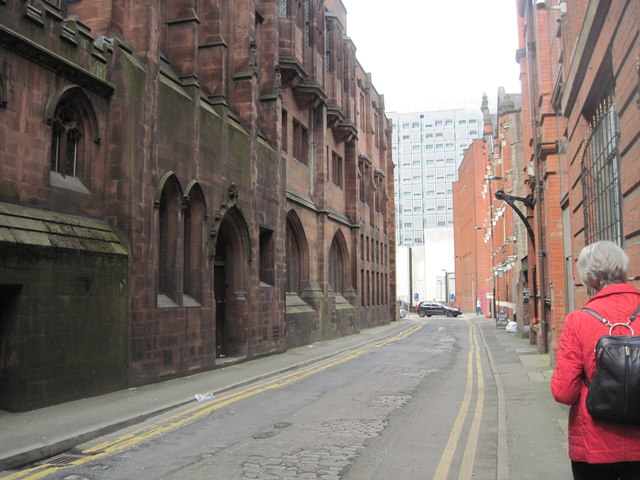
Image: © Tricia Neal Taken: 9 May 2012
Looking along the side of John Rylands Library, it is possible to see the original building nearest to the camera, with two extensions. The original is darker, and there is a doorway with a double arched window to the left and a small square window to the right. Then comes the first extension with two pointed windows, and finally the second extension with square windows. The original road paved with setts shows through where the tarmac has worn away, and there is a hoist along the right-hand side for unloading goods wagons. Wood Street Children's Mission and Working Men's Club buildings are on the right of the street.
Images are licensed for reuse under creativecommons.org/licenses/by-sa/2.0
Image Location
Latitude
53.480531
Longitude
-2.249491