Prattshayes Farm
Introduction
The photograph on this page of Prattshayes Farm by Derek Harper as part of the Geograph project.
The Geograph project started in 2005 with the aim of publishing, organising and preserving representative images for every square kilometre of Great Britain, Ireland and the Isle of Man.

There are currently over 7.5m images from over 14,400 individuals and you can help contribute to the project by visiting https://www.geograph.org.uk
Prattshayes Farm
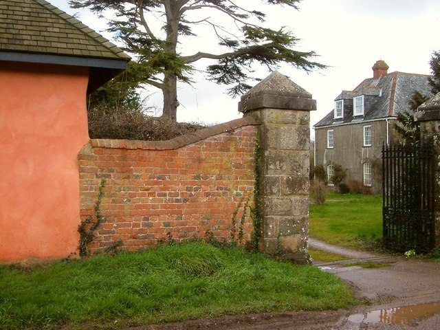
Image: © Derek Harper Taken: 9 Mar 2006
One of the listed gate piers http://list.english-heritage.org.uk/resultsingle.aspx?uid=1317664&searchtype=mapsearch, and a glimpse of the farmhouse, listed as "Pratshayes" http://list.english-heritage.org.uk/resultsingle.aspx?uid=1097877&searchtype=mapsearch . "The Drake family had a seat here. The present house may date from circa 1700".
Images are licensed for reuse under creativecommons.org/licenses/by-sa/2.0
Image Location
Latitude
50.618099
Longitude
-3.379695