Thunderton Place
Introduction
The photograph on this page of Thunderton Place by Anne Burgess as part of the Geograph project.
The Geograph project started in 2005 with the aim of publishing, organising and preserving representative images for every square kilometre of Great Britain, Ireland and the Isle of Man.

There are currently over 7.5m images from over 14,400 individuals and you can help contribute to the project by visiting https://www.geograph.org.uk
Thunderton Place
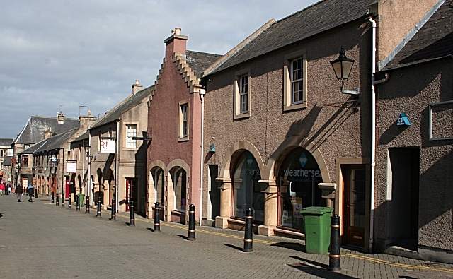
Image: © Anne Burgess Taken: 22 Mar 2007
Despite appearances, all the nearer buildings are modern, proving that it is still perfectly possible to build traditional buildings. Unfortunately they face the blank wall of a former supermarket and multistorey car park on the other side of the street.
Images are licensed for reuse under creativecommons.org/licenses/by-sa/2.0
Image Location
Latitude
57.647972
Longitude
-3.317511