Eas a'Chlaiginn on the Lower Nevis
Introduction
The photograph on this page of Eas a'Chlaiginn on the Lower Nevis by Andy Waddington as part of the Geograph project.
The Geograph project started in 2005 with the aim of publishing, organising and preserving representative images for every square kilometre of Great Britain, Ireland and the Isle of Man.

There are currently over 7.5m images from over 14,400 individuals and you can help contribute to the project by visiting https://www.geograph.org.uk
Eas a'Chlaiginn on the Lower Nevis
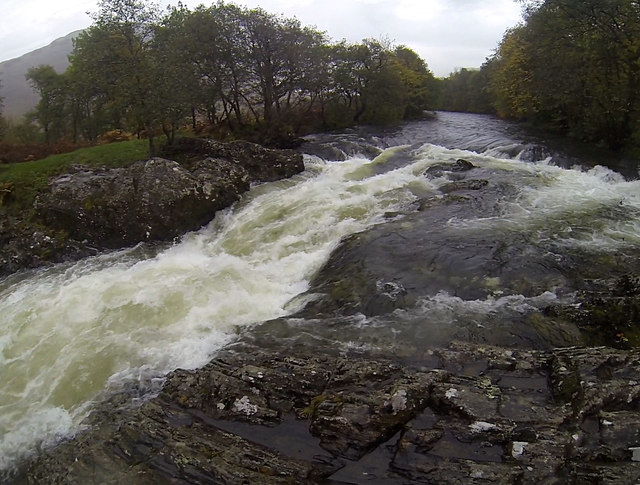
Image: © Andy Waddington Taken: 1 Nov 2013
From the Lower Falls at Polldubh to the take-out near Fort William, the Lower Nevis offers mostly gentle water with nothing more than shingle rapids and a few rocks to avoid. The exception is this rapid near the end of the trip which makes a fitting finale. Unfortunately, a recently fallen tree now lies across the outflow from this rapid, making it extremely dangerous to run at this level.
Images are licensed for reuse under creativecommons.org/licenses/by-sa/2.0
Image Location
Latitude
56.819419
Longitude
-5.080013