Disraeli Street, Belfast
Introduction
The photograph on this page of Disraeli Street, Belfast by Albert Bridge as part of the Geograph project.
The Geograph project started in 2005 with the aim of publishing, organising and preserving representative images for every square kilometre of Great Britain, Ireland and the Isle of Man.

There are currently over 7.5m images from over 14,400 individuals and you can help contribute to the project by visiting https://www.geograph.org.uk
Disraeli Street, Belfast
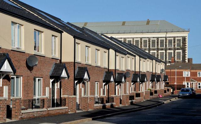
Image: © Albert Bridge Taken: 12 Nov 2013
Disraeli Street presents an interesting example of the growth of Belfast in the late 19th century. In 1877 it had 18 houses off the Crumlin Road. In 1890 there were 51. They increased to more than 160 by 1901 when it extended south to Woodvale Street. This is the recently rebuilt western side, seen from Ohio Street close to Leopold Street Image It now turns left and no longer runs through to the Crumlin Road. For reference purposes the former Brookfield Mill Image is at top right.
Images are licensed for reuse under creativecommons.org/licenses/by-sa/2.0
Image Location
Latitude
54.610946
Longitude
-5.959876