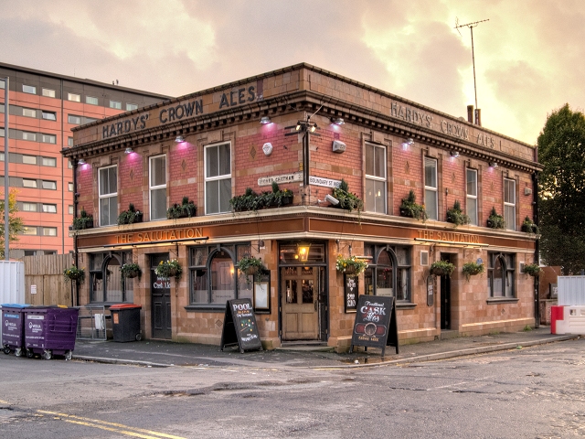
The Salutation
Introduction
The photograph on this page of The Salutation by David Dixon as part of the Geograph project.
The Geograph project started in 2005 with the aim of publishing, organising and preserving representative images for every square kilometre of Great Britain, Ireland and the Isle of Man.
There are currently over 7.5m images from over 14,400 individuals and you can help contribute to the project by visiting https://www.geograph.org.uk

Image: © David Dixon Taken: 3 Nov 2013
The Salutation, known as “Sal” to regulars, is shown on old maps to have stood at the corner Boundary Street and Higher Chatham Street from at least as early as 1844. It is thought to be one of only two pubs in Manchester to have retained its 1840s décor. The Sal was saved from closure when it was bought by Manchester Metropolitan University in 2011. At the time, a spokesman for MMU said The Salutation Pub is a local landmark which has been a popular haunt of Manchester Met staff and students over many years. Buying a pub is a bit out of the ordinary but represents a strategic acquisition for the university – surrounded by land which we either own or occupy” (http://www.manchestersfinest.com/articles/save-the-sal/ Manchester’s Finest). As a testament to its history, the Boundary Street side of the building bears a blue plaque commemorating Charlotte Brontë’s visit to Manchester in 1846 when she began to write the novel Jane Eyre (Image]).

