Closed Footpath
Introduction
The photograph on this page of Closed Footpath by Keith Evans as part of the Geograph project.
The Geograph project started in 2005 with the aim of publishing, organising and preserving representative images for every square kilometre of Great Britain, Ireland and the Isle of Man.

There are currently over 7.5m images from over 14,400 individuals and you can help contribute to the project by visiting https://www.geograph.org.uk
Closed Footpath
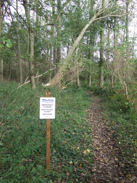
Image: © Keith Evans Taken: 3 Nov 2013
The sign says 'Emergency closure Right of way closed Tree down' presumably it came down with the high winds of Monday 28 October 2013. Seen in Dodnash Wood near to Bentley, Suffolk.
Images are licensed for reuse under creativecommons.org/licenses/by-sa/2.0
Image Location
Latitude
51.98133
Longitude
1.066306