Bridge No. 1 Coventry Canal
Introduction
The photograph on this page of Bridge No. 1 Coventry Canal by E Gammie as part of the Geograph project.
The Geograph project started in 2005 with the aim of publishing, organising and preserving representative images for every square kilometre of Great Britain, Ireland and the Isle of Man.

There are currently over 7.5m images from over 14,400 individuals and you can help contribute to the project by visiting https://www.geograph.org.uk
Bridge No. 1 Coventry Canal
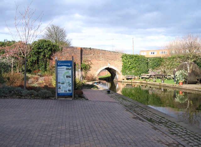
Image: © E Gammie Taken: 21 Mar 2007
Drapers Field Bridge[1] at the exit from the canal basin. The sign describes the Coventry Greenway which starts here and runs along the canal towpath to Hawkesbury Junction ( Image ). There is no towpath under the bridge, you have to go to the left, cross the bridge and join the towpath on the other side of the canal (here.. Image ). For the last bridge on the Coventry Canal (or first, travelling in the opposite direction), see Image
Images are licensed for reuse under creativecommons.org/licenses/by-sa/2.0
Image Location


Leaflet Map data © OpenStreetMap
Latitude
52.414017
Longitude
-1.510815