Bredhurst, Kent
Introduction
The photograph on this page of Bredhurst, Kent by Malc McDonald as part of the Geograph project.
The Geograph project started in 2005 with the aim of publishing, organising and preserving representative images for every square kilometre of Great Britain, Ireland and the Isle of Man.

There are currently over 7.5m images from over 14,400 individuals and you can help contribute to the project by visiting https://www.geograph.org.uk
Bredhurst, Kent
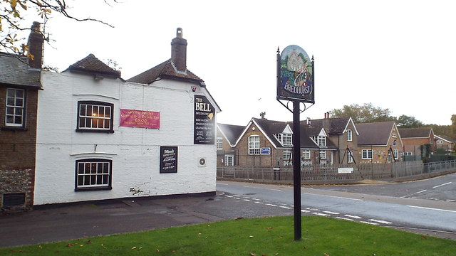
Image: © Malc McDonald Taken: 2 Nov 2013
The village of Bredhurst in Kent. In the foreground is the village sign. Beyond it is the village pub, The Bell, while on the other side of the road is the village primary school. This image was taken during wet weather. The smudge in the centre of the image is a drop of water on the camera lens.
Images are licensed for reuse under creativecommons.org/licenses/by-sa/2.0
Image Location
Latitude
51.331254
Longitude
0.576497