Site of former Kirtlebridge station, WCML 2000
Introduction
The photograph on this page of Site of former Kirtlebridge station, WCML 2000 by Ben Brooksbank as part of the Geograph project.
The Geograph project started in 2005 with the aim of publishing, organising and preserving representative images for every square kilometre of Great Britain, Ireland and the Isle of Man.

There are currently over 7.5m images from over 14,400 individuals and you can help contribute to the project by visiting https://www.geograph.org.uk
Site of former Kirtlebridge station, WCML 2000
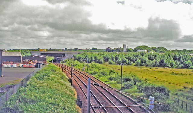
Image: © Ben Brooksbank Taken: 21 Jun 2000
View southward from B722 to the large bridge of the new A74(M). This is situated where the station had been, until it closed 13/6/60 to passengers (6/4/64 to goods). The view is up the ex-Caledonian Railway (Glasgow - Carlisle) section of the West Coast Main Line, electrified 1974. Off to the right used to be the branch line to Annan (Shawhill) and over the Solway Viaduct to Brayton on the Maryport & Carlisle Railway; this lasted to Brayton only until 20/5/21, to Annan for passengers until 27/4/31 (goods 28/2/55, however).
Images are licensed for reuse under creativecommons.org/licenses/by-sa/2.0
Image Location
Latitude
55.050483
Longitude
-3.212865