Grand Union Canal: Cowroast Winding Hole
Introduction
The photograph on this page of Grand Union Canal: Cowroast Winding Hole by Nigel Cox as part of the Geograph project.
The Geograph project started in 2005 with the aim of publishing, organising and preserving representative images for every square kilometre of Great Britain, Ireland and the Isle of Man.

There are currently over 7.5m images from over 14,400 individuals and you can help contribute to the project by visiting https://www.geograph.org.uk
Grand Union Canal: Cowroast Winding Hole
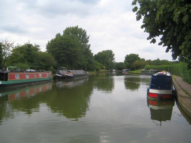
Image: © Nigel Cox Taken: 3 Sep 2013
A winding hole is a deliberately widened reach of the canal that enables long narrowboats to turn through 180 degrees. Usually these are found next to old wharves where working boats might have had a reason to need to turn, and this one is no exception being shown on the Ordnance Survey map of 1877. However the widening here is quite small, and if there are double breasted moored boats on the other side, as there were on the day the photograph was taken, it would be difficult to turn a 70 foot boat without clouting the outer moored one or the towpath bank on the right. This is the southern end of the Tring summit cut.
Images are licensed for reuse under creativecommons.org/licenses/by-sa/2.0
Image Location
Latitude
51.784075
Longitude
-0.613045