
Bournemouth: shared foot/cycle path in the Lower Gardens
Introduction
The photograph on this page of Bournemouth: shared foot/cycle path in the Lower Gardens by Chris Downer as part of the Geograph project.
The Geograph project started in 2005 with the aim of publishing, organising and preserving representative images for every square kilometre of Great Britain, Ireland and the Isle of Man.

There are currently over 7.5m images from over 14,400 individuals and you can help contribute to the project by visiting https://www.geograph.org.uk
Bournemouth: shared foot/cycle path in the Lower Gardens
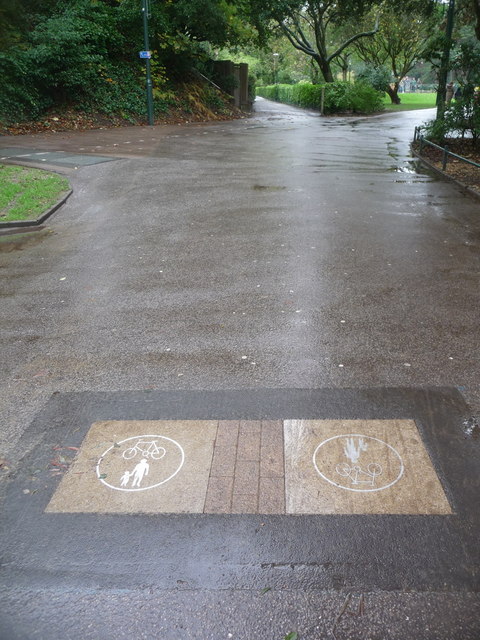
Image: © Chris Downer Taken: 1 Nov 2013
The western peripheral path all through Bournemouth's pleasure gardens form a cycle route with a shared path, denoted here by an image of the road sign signifying this set into the surface. Ahead of us, cyclists must take the left-hand fork while the right-hand route, heading into the busiest part of the Gardens in the town centre, is for pedestrians only. It is the left-hand route, however, that is officially a public right of way - Image
Images are licensed for reuse under creativecommons.org/licenses/by-sa/2.0
Image Location

Latitude
50.717573
Longitude
-1.876571