Village Sign
Introduction
The photograph on this page of Village Sign by Tony Hibberd as part of the Geograph project.
The Geograph project started in 2005 with the aim of publishing, organising and preserving representative images for every square kilometre of Great Britain, Ireland and the Isle of Man.

There are currently over 7.5m images from over 14,400 individuals and you can help contribute to the project by visiting https://www.geograph.org.uk
Village Sign
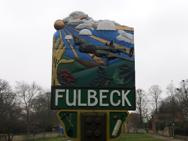
Image: © Tony Hibberd Taken: 5 Mar 2013
The Fulbeck village sign pays tribute to the two roles played by the nearby former WWII airfield. Firstly the parachutes refer to the USAAF Troop Carrier Groups that took personnel into battle on D-Day, D-Day and the Rhine Crossing. The Lancaster refers to its subsequent usage by RAF Bomber Command NB: A non aviation image is depicted on the reverse side
Images are licensed for reuse under creativecommons.org/licenses/by-sa/2.0
Image Location
Latitude
53.042553
Longitude
-0.586271