Near site of Kirkby-in-Ashfield (LMS) station, 2000
Introduction
The photograph on this page of Near site of Kirkby-in-Ashfield (LMS) station, 2000 by Ben Brooksbank as part of the Geograph project.
The Geograph project started in 2005 with the aim of publishing, organising and preserving representative images for every square kilometre of Great Britain, Ireland and the Isle of Man.

There are currently over 7.5m images from over 14,400 individuals and you can help contribute to the project by visiting https://www.geograph.org.uk
Near site of Kirkby-in-Ashfield (LMS) station, 2000
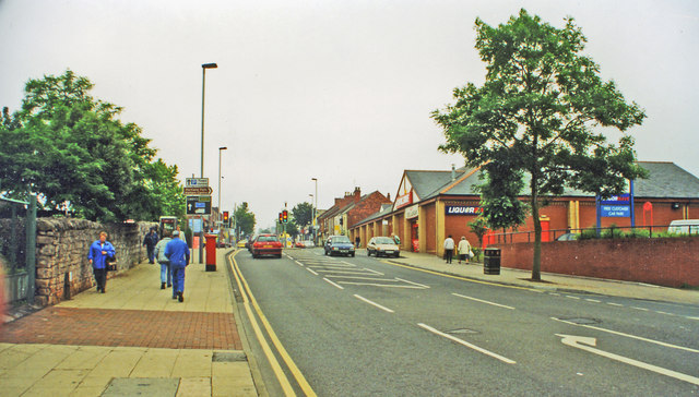
Image: © Ben Brooksbank Taken: 3 Jul 2000
View eastward on B6020 Urban Road/Station Street, Kirkby-in-Ashfield. Actually, this is just past where underneath ran the ex-Midland Nottingham - Mansfield - Worksop line, the station ('Kirkby-in-Ashfield East' from 15/6/59) being on the north side of this road. It had been a junction of a line from Pye Bridge and closed 6/9/65, when workmens' train from Pye Bridge ceased, the Nottingham - Worksop service having ceased 12/10/64. In more recent times it has been restored, on a different route (q.v.), as the Robin Hood Line.
Images are licensed for reuse under creativecommons.org/licenses/by-sa/2.0
Image Location
Latitude
53.09937
Longitude
-1.248887