Beeston Iron Lock
Introduction
The photograph on this page of Beeston Iron Lock by David Stowell as part of the Geograph project.
The Geograph project started in 2005 with the aim of publishing, organising and preserving representative images for every square kilometre of Great Britain, Ireland and the Isle of Man.

There are currently over 7.5m images from over 14,400 individuals and you can help contribute to the project by visiting https://www.geograph.org.uk
Beeston Iron Lock
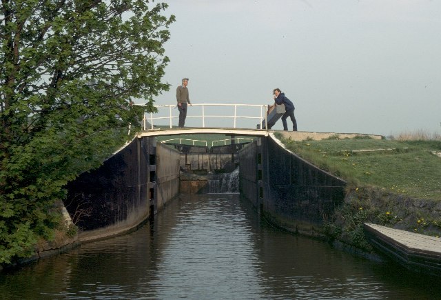
Image: © David Stowell Taken: Unknown
This lock on the Shropshire Union Canal is unusual in that it is built of iron rather than the conventional stone or brick. This is reputedly due to the prevailing geological conditions. According to "The Shell Book of Inland Waterways" by Hugh McKnight, this lock, dated 1828, replaced the original lock which had collapsed due to unstable sand at the site in 1797, but it was not until this lock and Beeston Stone lock with some of the canal were rebuilt that the problem was permanently solved.
Images are licensed for reuse under creativecommons.org/licenses/by-sa/2.0
Image Location
Latitude
53.133473
Longitude
-2.669568