Bus turning circle, Norwood Gardens, Southwell
Introduction
The photograph on this page of Bus turning circle, Norwood Gardens, Southwell by Richard Vince as part of the Geograph project.
The Geograph project started in 2005 with the aim of publishing, organising and preserving representative images for every square kilometre of Great Britain, Ireland and the Isle of Man.

There are currently over 7.5m images from over 14,400 individuals and you can help contribute to the project by visiting https://www.geograph.org.uk
Bus turning circle, Norwood Gardens, Southwell
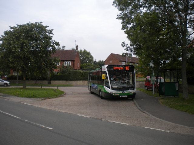
Image: © Richard Vince Taken: 24 Aug 2013
One of Nottingham City Transport's soon to be withdrawn Optare Versas waits time in the turning circle on Lower Kirklington Road near the northern edge of Southwell. Norwood Gardens, after which the turning circle is named, is a residential road that has direct pedestrian access to the turning circle (hidden behind the bus in this shot).
Images are licensed for reuse under creativecommons.org/licenses/by-sa/2.0
Image Location
Latitude
53.084773
Longitude
-0.957854