The "Interpoint" Building, Belfast (69)
Introduction
The photograph on this page of The "Interpoint" Building, Belfast (69) by Albert Bridge as part of the Geograph project.
The Geograph project started in 2005 with the aim of publishing, organising and preserving representative images for every square kilometre of Great Britain, Ireland and the Isle of Man.

There are currently over 7.5m images from over 14,400 individuals and you can help contribute to the project by visiting https://www.geograph.org.uk
The "Interpoint" Building, Belfast (69)
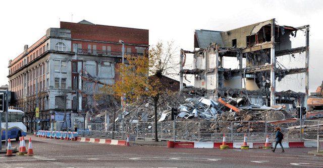
Image: © Albert Bridge Taken: 29 Oct 2013
The view from the corner of York Street and Gt Patrick Street. Most of the building has now been demolished save for the bit on the right. The photograph was taken during the morning tea break but a few minutes later work had resumed with gusto. It looks as if all will be gone by the end of the week with only the rubble left for removal.
Images are licensed for reuse under creativecommons.org/licenses/by-sa/2.0
Image Location
Latitude
54.604588
Longitude
-5.929395