Former schoolhouse, Backley
Introduction
The photograph on this page of Former schoolhouse, Backley by Jaggery as part of the Geograph project.
The Geograph project started in 2005 with the aim of publishing, organising and preserving representative images for every square kilometre of Great Britain, Ireland and the Isle of Man.

There are currently over 7.5m images from over 14,400 individuals and you can help contribute to the project by visiting https://www.geograph.org.uk
Former schoolhouse, Backley
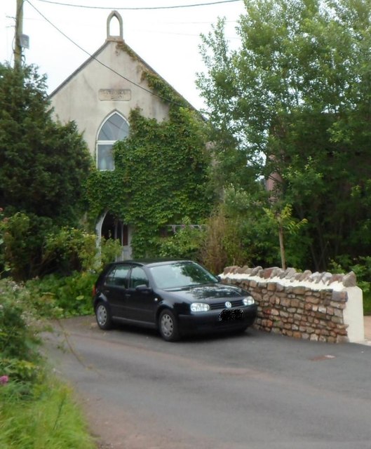
Image: © Jaggery Taken: 13 Jul 2012
The ivy-clad building near the entrance http://www.geograph.org.uk/photo/3719209 to Backwell Village Club has a faded inscription below the former bell tower. The letters HOOL can be discerned, from which I've assumed that this used to be a school.
Images are licensed for reuse under creativecommons.org/licenses/by-sa/2.0
Image Location
Latitude
51.419122
Longitude
-2.724456