Crossroads in Bathgate
Introduction
The photograph on this page of Crossroads in Bathgate by M J Richardson as part of the Geograph project.
The Geograph project started in 2005 with the aim of publishing, organising and preserving representative images for every square kilometre of Great Britain, Ireland and the Isle of Man.

There are currently over 7.5m images from over 14,400 individuals and you can help contribute to the project by visiting https://www.geograph.org.uk
Crossroads in Bathgate
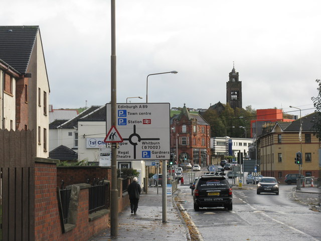
Image: © M J Richardson Taken: 27 Oct 2013
Looking east to the junction of the A89 Glasgow road with the A800 [left] to Linlithgow and Menzies Road [right] leading to the B7002 to Whitburn. The tower is the bell tower of St David's Church.
Images are licensed for reuse under creativecommons.org/licenses/by-sa/2.0
Image Location
Latitude
55.901734
Longitude
-3.646846