Glasgow and the Clyde from the air
Introduction
The photograph on this page of Glasgow and the Clyde from the air by Thomas Nugent as part of the Geograph project.
The Geograph project started in 2005 with the aim of publishing, organising and preserving representative images for every square kilometre of Great Britain, Ireland and the Isle of Man.

There are currently over 7.5m images from over 14,400 individuals and you can help contribute to the project by visiting https://www.geograph.org.uk
Glasgow and the Clyde from the air
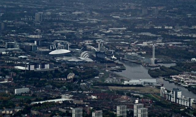
Image: © Thomas Nugent Taken: 21 Oct 2013
A gloomy day, but many of the city's more modern architectural landmarks are clearly visible, including the recently opened Hydro Arena to the left of centre.
Images are licensed for reuse under creativecommons.org/licenses/by-sa/2.0
Image Location
Latitude
55.877077
Longitude
-4.407238