Station Road
Introduction
The photograph on this page of Station Road by Alan Walker as part of the Geograph project.
The Geograph project started in 2005 with the aim of publishing, organising and preserving representative images for every square kilometre of Great Britain, Ireland and the Isle of Man.

There are currently over 7.5m images from over 14,400 individuals and you can help contribute to the project by visiting https://www.geograph.org.uk
Station Road
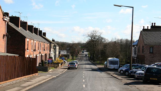
Image: © Alan Walker Taken: 19 Mar 2007
The photograph is looking east along Station Road (B6014) and was taken from near (just behind the viewpoint) a now disused, mineral railway line crossed the road. On the left, between the Image and the fencing, is the entrance to a small Image For another photograph of Station Road taken from approximately the same viewpoint but looking in the opposite direction, click here Image Ahead (easterly) Image continues toward its junction with Image at the ‘Corner Pin’ (look on the left, beyond the row of terraced houses, for the white building with the ‘pub’ sign). Behind the viewpoint the B6014 becomes Image at its junction with Pit Lane and Old Colliery Yard.
Images are licensed for reuse under creativecommons.org/licenses/by-sa/2.0
Image Location
Latitude
53.13733
Longitude
-1.378125