
Rampside Gas Terminal & Roosecote Power Station
Introduction
The photograph on this page of Rampside Gas Terminal & Roosecote Power Station by Rob Farrow as part of the Geograph project.
The Geograph project started in 2005 with the aim of publishing, organising and preserving representative images for every square kilometre of Great Britain, Ireland and the Isle of Man.

There are currently over 7.5m images from over 14,400 individuals and you can help contribute to the project by visiting https://www.geograph.org.uk
Rampside Gas Terminal & Roosecote Power Station
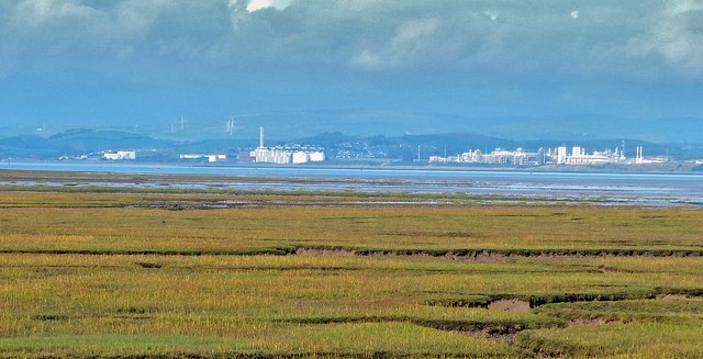
Image: © Rob Farrow Taken: 19 Oct 2013
Roosecote Power Station (on the left in this image) is a gas fired power station on the coast just south of Barrow in Furness; the chimney and two cylindrical storage containers belong to this plant which is actually situated in the next gridsquare to the north (SD2268) The larger complex on the right of the image is Rampside Gas Terminal, which I have taken as the subject reference for the photo. Behind and to the left of the power station can be seen another form of power generation in the form of the wind turbines of the Hare Slack Hill Wind Farm near Ireleth, though you may need to use the "More Sizes" option to see these reasonably clearly. This photograph was taken looking across the Walney Channel/Piel Channel from South Walney near South End Haws. Wikipedia article on Roosecote P.S. http://en.wikipedia.org/wiki/Roosecote_Power_Station Wikipedia article on Rampside Gas terminal http://en.wikipedia.org/wiki/Rampside_Gas_Terminal
Images are licensed for reuse under creativecommons.org/licenses/by-sa/2.0
Image Location

Latitude
54.099333
Longitude
-3.18662