South end of Farringdon station
Introduction
The photograph on this page of South end of Farringdon station by Richard Vince as part of the Geograph project.
The Geograph project started in 2005 with the aim of publishing, organising and preserving representative images for every square kilometre of Great Britain, Ireland and the Isle of Man.

There are currently over 7.5m images from over 14,400 individuals and you can help contribute to the project by visiting https://www.geograph.org.uk
South end of Farringdon station
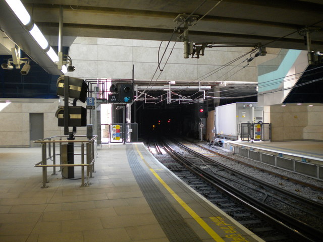
Image: © Richard Vince Taken: 13 Jul 2013
Looking south into the tunnel that takes the Thameslink line under Smithfield Markets from near the point at which this line diverged from the "widened lines" to Moorgate. To accommodate longer trains on this very heavily used line, it was necessary to extend the platforms at Farringdon across the junction (extension of the platforms at the other end proving impracticable), thus severing the link to Moorgate. On the left, in front of the signal, the CCTV monitors provided so that train drivers can check that the doors are clear can be seen. Farringdon is the point at which trains switch between the two main line electrification systems used in Britain, hence the provision of both 25kV AC overhead wires and 750V DC third rails.
Images are licensed for reuse under creativecommons.org/licenses/by-sa/2.0
Image Location
Latitude
51.519435
Longitude
-0.104514