Fforest
Introduction
The photograph on this page of Fforest by Alan Richards as part of the Geograph project.
The Geograph project started in 2005 with the aim of publishing, organising and preserving representative images for every square kilometre of Great Britain, Ireland and the Isle of Man.

There are currently over 7.5m images from over 14,400 individuals and you can help contribute to the project by visiting https://www.geograph.org.uk
Fforest
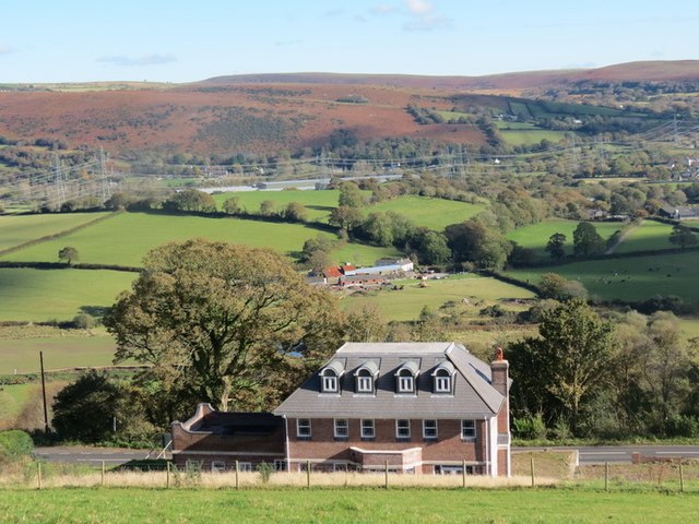
Image: © Alan Richards Taken: 21 Oct 2012
Edrych i lawr at anhedd-dy newydd yn y Fforest o lwybr cyhoeddus. Y ffarm yng nghanol y llun yw Talfan Fawr a'r ucheldir yn y pellter yw Graig Fawr (Fe'i hadwaenir yn lleol hefyd yn 'Jericho'). Looking down on a new property in Fforest from a public footpath. The farm in the centre of the photo is Talfan Fawr (trans. [farm] at the end of the hill) and the bracken covered upland in the distance is known as Graig Fawr (trans. Big Hill) but also known locally as 'Jericho'.
Images are licensed for reuse under creativecommons.org/licenses/by-sa/2.0
Image Location
Latitude
51.726273
Longitude
-4.054622