Those aren't white lines
Introduction
The photograph on this page of Those aren't white lines by Neil Owen as part of the Geograph project.
The Geograph project started in 2005 with the aim of publishing, organising and preserving representative images for every square kilometre of Great Britain, Ireland and the Isle of Man.

There are currently over 7.5m images from over 14,400 individuals and you can help contribute to the project by visiting https://www.geograph.org.uk
Those aren't white lines
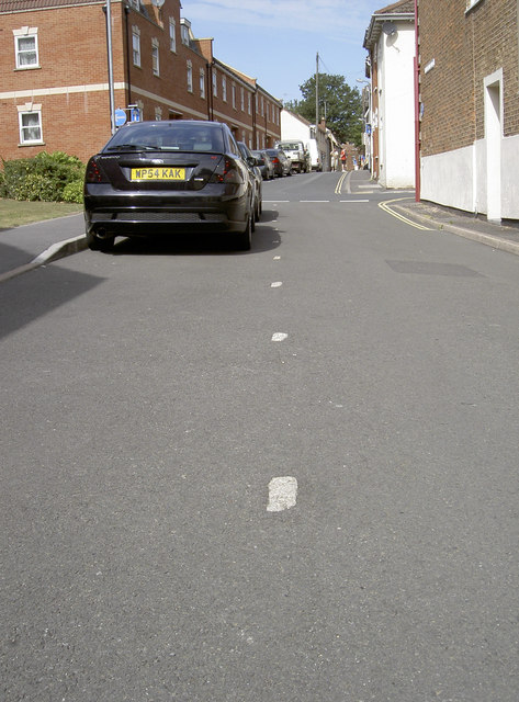
Image: © Neil Owen Taken: 5 Sep 2013
These marks in Horsepond Lane (formerly the Wayhure) are in fact granite markers that point to some of Bridgwater's past. In the thirteenth century the lane was a lot narrower; however, the marks are also thought to indicate the eastern extent of the former Franciscan Friary, which was here until the Dissolution in 1538. The lane was only widened in 2008.
Images are licensed for reuse under creativecommons.org/licenses/by-sa/2.0
Image Location
Latitude
51.126242
Longitude
-3.005518