Friarn Street benchmark
Introduction
The photograph on this page of Friarn Street benchmark by Neil Owen as part of the Geograph project.
The Geograph project started in 2005 with the aim of publishing, organising and preserving representative images for every square kilometre of Great Britain, Ireland and the Isle of Man.

There are currently over 7.5m images from over 14,400 individuals and you can help contribute to the project by visiting https://www.geograph.org.uk
Friarn Street benchmark
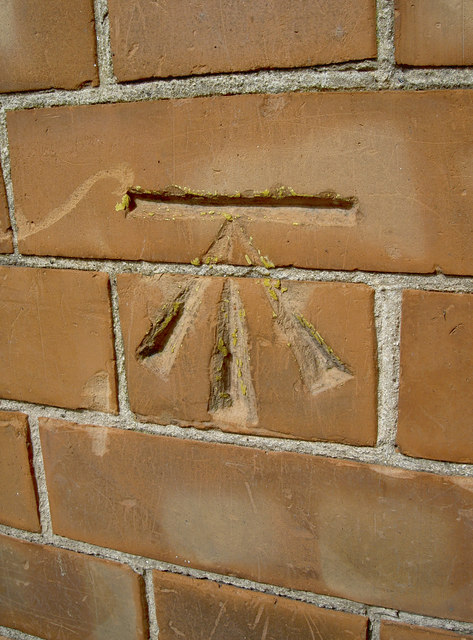
Image: © Neil Owen Taken: 5 Sep 2013
A cutmark in the brickwork of number . The yellow crayon marks indicate that it had been used in the more recent past. See Image] for a wider view and http://www.bench-marks.org.uk/bm51988 for the entry in the Benchmark Database.
Images are licensed for reuse under creativecommons.org/licenses/by-sa/2.0
Image Location
Latitude
51.126701
Longitude
-3.004385