Three spires
Introduction
The photograph on this page of Three spires by E Gammie as part of the Geograph project.
The Geograph project started in 2005 with the aim of publishing, organising and preserving representative images for every square kilometre of Great Britain, Ireland and the Isle of Man.

There are currently over 7.5m images from over 14,400 individuals and you can help contribute to the project by visiting https://www.geograph.org.uk
Three spires
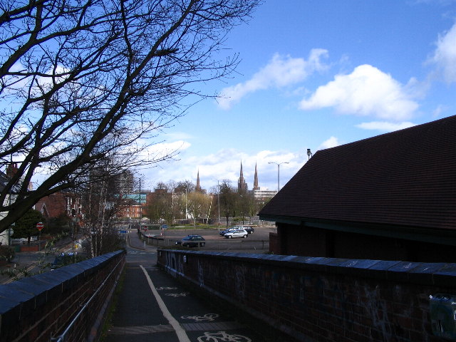
Image: © E Gammie Taken: 18 Mar 2007
Looking down the ramp of 'Anarchy Bridge' towards the city centre and the three spires traditionally associated with Coventry - left, Holy Trinity Image, centre St. Michael's (the 'old' cathedral Image ) and right, Christ Church or Greyfriars ( Image ). Directly ahead is Grosvenor Road and the car park is on the site of what is soon to become a 'fabulous new development'.
Images are licensed for reuse under creativecommons.org/licenses/by-sa/2.0
Image Location
Latitude
52.403165
Longitude
-1.517255