Course of old railway, Laurencetown
Introduction
The photograph on this page of Course of old railway, Laurencetown by Albert Bridge as part of the Geograph project.
The Geograph project started in 2005 with the aim of publishing, organising and preserving representative images for every square kilometre of Great Britain, Ireland and the Isle of Man.

There are currently over 7.5m images from over 14,400 individuals and you can help contribute to the project by visiting https://www.geograph.org.uk
Course of old railway, Laurencetown
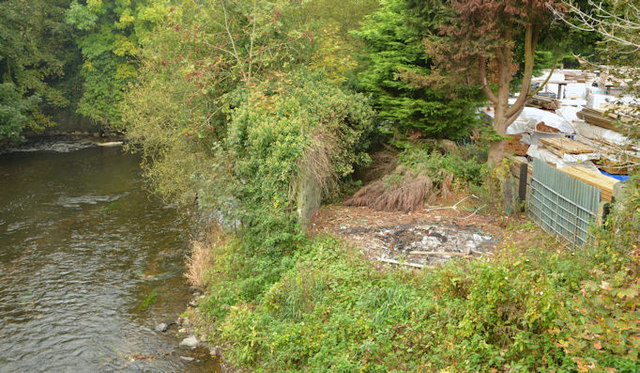
Image: © Albert Bridge Taken: 15 Oct 2013
The course of the Banbridge – Scarva line (closed 1955) - right) immediately after it had crossed the Point Road by this level crossing Image, is still clearly visible (lower right). The line continued towards Laurencetown station and Scarva by a bridge across the Bann (left). The bridge has gone but an abutment remains just above the river at upper left – see also Image The Google map is representational only. Subject positioned using the satellite photograph.
Images are licensed for reuse under creativecommons.org/licenses/by-sa/2.0
Image Location
Latitude
54.378675
Longitude
-6.308185