Carmyle railway station, Glasgow, 2013
Introduction
The photograph on this page of Carmyle railway station, Glasgow, 2013 by Nigel Thompson as part of the Geograph project.
The Geograph project started in 2005 with the aim of publishing, organising and preserving representative images for every square kilometre of Great Britain, Ireland and the Isle of Man.

There are currently over 7.5m images from over 14,400 individuals and you can help contribute to the project by visiting https://www.geograph.org.uk
Carmyle railway station, Glasgow, 2013
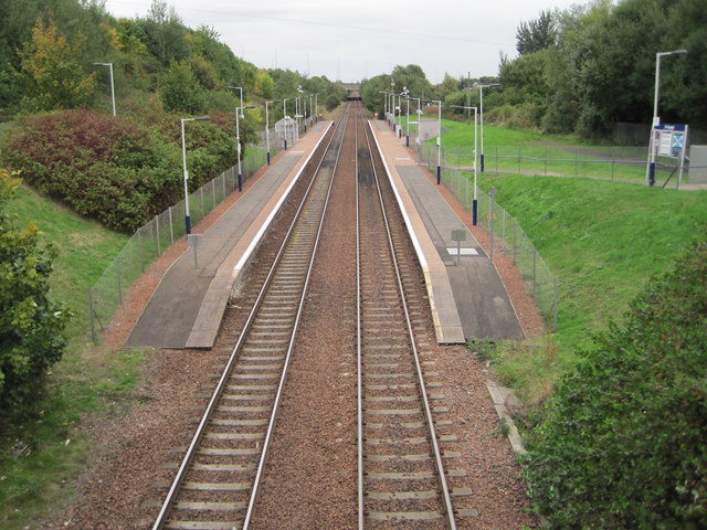
Image: © Nigel Thompson Taken: 12 Oct 2013
Opened in 1866 by the Rutherglen and Coatbridge Railway, later part of the Caledonian Railway, this station closed in 1964. It was rebuilt and reopened in 1993 as part of the Glasgow to Whifflet line. View east towards Mount Vernon and Whifflet, prior to electrification. For a view in the opposite direction some three years later, see Image The station had also previously been the junction for the Glasgow Central Railway via Tollcross and Bridgeton Cross, with a further 2 platforms to the left. These are now buried underneath the motorway embankment.
Images are licensed for reuse under creativecommons.org/licenses/by-sa/2.0
Image Location
Latitude
55.834246
Longitude
-4.158175