St Teilo's Church
Introduction
The photograph on this page of St Teilo's Church by Adrian Dust as part of the Geograph project.
The Geograph project started in 2005 with the aim of publishing, organising and preserving representative images for every square kilometre of Great Britain, Ireland and the Isle of Man.

There are currently over 7.5m images from over 14,400 individuals and you can help contribute to the project by visiting https://www.geograph.org.uk
St Teilo's Church
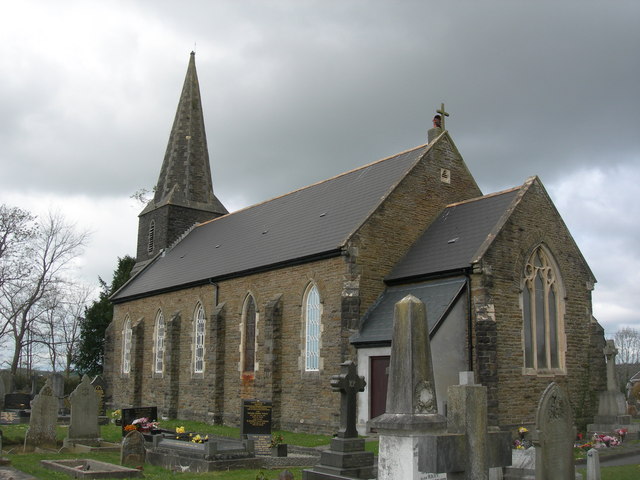
Image: © Adrian Dust Taken: 7 Apr 2011
The Church Spire was used by Ordnance Survey as a 3rd Order Triangulation Point (Intersected Station SN61/INT002). There is an OS Bench Mark on the tower as well. http://www.geograph.org.uk/photo/3698550
Images are licensed for reuse under creativecommons.org/licenses/by-sa/2.0
Image Location
Latitude
51.71019
Longitude
-4.033194