Saunderton Split - railway tracks diverge to pass a hill
Introduction
The photograph on this page of Saunderton Split - railway tracks diverge to pass a hill by David Hawgood as part of the Geograph project.
The Geograph project started in 2005 with the aim of publishing, organising and preserving representative images for every square kilometre of Great Britain, Ireland and the Isle of Man.

There are currently over 7.5m images from over 14,400 individuals and you can help contribute to the project by visiting https://www.geograph.org.uk
Saunderton Split - railway tracks diverge to pass a hill
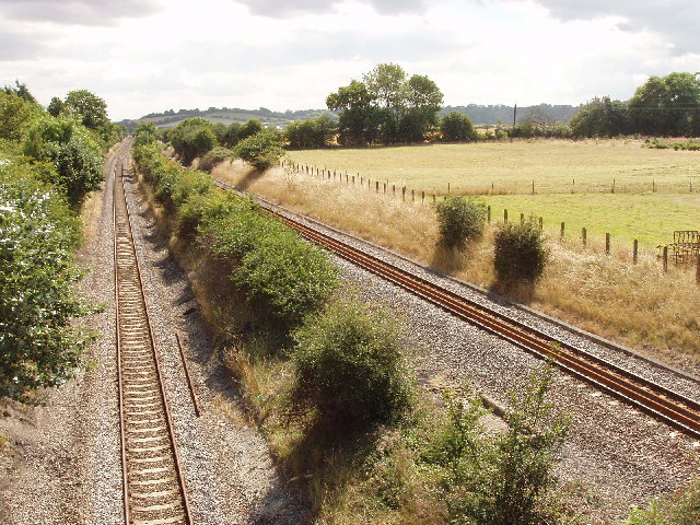
Image: © David Hawgood Taken: 12 Aug 2005
This photo is taken looking South from a road bridge near Saunderton Lee.The right hand track, northbound, reaches this point after curving around with an embankment and a cutting. The left hand track has emerged from a tunnel further up the hill. A correspondent has explained the history: "What is now the northbound line was opened in 1862 as a single line branch from Maidenhead via High Wycombe, then Princes Risborough and Thame to Oxford. Soon after 1900 the bit from High Wycombe to Princes Risborough was doubled to form part of the GWR's new shortcut to Birmingham. The climb to Saunderton summit was steeper going south, so to ease the ascending gradient to mainline standards the summit was lowered, which necessitated the tunnel." Also see Image near the tunnel.
Images are licensed for reuse under creativecommons.org/licenses/by-sa/2.0
Image Location


Leaflet Map data © OpenStreetMap
Latitude
51.689544
Longitude
-0.83381