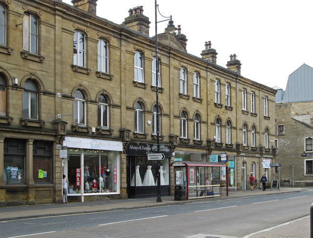
Sowerby Bridge - Ryburn Buildings - West Street frontage
Introduction
The photograph on this page of Sowerby Bridge - Ryburn Buildings - West Street frontage by Dave Bevis as part of the Geograph project.
The Geograph project started in 2005 with the aim of publishing, organising and preserving representative images for every square kilometre of Great Britain, Ireland and the Isle of Man.
There are currently over 7.5m images from over 14,400 individuals and you can help contribute to the project by visiting https://www.geograph.org.uk

Image: © Dave Bevis Taken: 4 Sep 2013
It has been difficult to find out much about the history of this row of shops, other than that they are called Ryburn Buildings and have a date stone of 1884. The building is not listed by English Heritage, but it is within the boundaries of the Sowerby Bridge Conservation Area. However, Calderdale Council have not published an online version of the Conservation Area Appraisal (this document normally contains more information on the notable buildings within a Conservation Area). For other views of this building, please see Image, Image, Image and Image

