Corner of a field and bridleway, Spennells, Kidderminster
Introduction
The photograph on this page of Corner of a field and bridleway, Spennells, Kidderminster by P L Chadwick as part of the Geograph project.
The Geograph project started in 2005 with the aim of publishing, organising and preserving representative images for every square kilometre of Great Britain, Ireland and the Isle of Man.

There are currently over 7.5m images from over 14,400 individuals and you can help contribute to the project by visiting https://www.geograph.org.uk
Corner of a field and bridleway, Spennells, Kidderminster
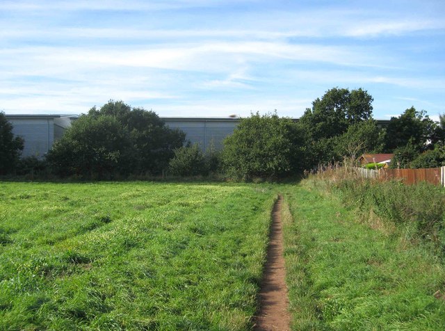
Image: © P L Chadwick Taken: 6 Oct 2013
Behind the hedge is the Kidderminster - Worcester railway line. Behind that are some industrial units which are quite recent. In the foreground is a bridlepath, which forms part of a circular path called Railway Path on the OS map. At the corner the path goes left but the bridleway turns right and runs adjacent to the railway line for some distance.
Images are licensed for reuse under creativecommons.org/licenses/by-sa/2.0
Image Location
Latitude
52.364536
Longitude
-2.236395