Ordnance Survey Benchmark - Carmarthen, Picton's Monument
Introduction
The photograph on this page of Ordnance Survey Benchmark - Carmarthen, Picton's Monument by N Scott as part of the Geograph project.
The Geograph project started in 2005 with the aim of publishing, organising and preserving representative images for every square kilometre of Great Britain, Ireland and the Isle of Man.

There are currently over 7.5m images from over 14,400 individuals and you can help contribute to the project by visiting https://www.geograph.org.uk
Ordnance Survey Benchmark - Carmarthen, Picton's Monument
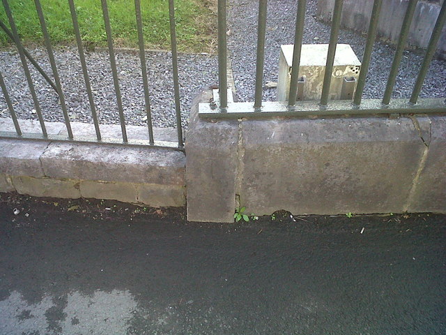
Image: © N Scott Taken: 8 Oct 2013
Ordnance Survey Benchmark (OSBM) used for levelling height above Ordnance Datum (OD). Height: 30.2588m OD (Newlyn). Mark verified by the Ordnance Survey in 1976. Description: WALL NE ANG PICTON MON N FACE. 0.5m above ground. 3rd Order BM. The mark was used on the Llanstephan to Dolfor Toll-house line of the First Primary Levelling of England & Wales in 1856-1857. It was levelled with a height of 99.615' above OD (Liverpool). Description: 17. Mark on base of railing enclosing Picton's Monument ; 2.07 ft. above surface. Page 576 of the abstract: http://www.bench-marks.org.uk/ew1gl/1GLA_576.png Close=up: Image
Images are licensed for reuse under creativecommons.org/licenses/by-sa/2.0
Image Location
Latitude
51.855219
Longitude
-4.320724