Trongate
Introduction
The photograph on this page of Trongate by Thomas Nugent as part of the Geograph project.
The Geograph project started in 2005 with the aim of publishing, organising and preserving representative images for every square kilometre of Great Britain, Ireland and the Isle of Man.

There are currently over 7.5m images from over 14,400 individuals and you can help contribute to the project by visiting https://www.geograph.org.uk
Trongate
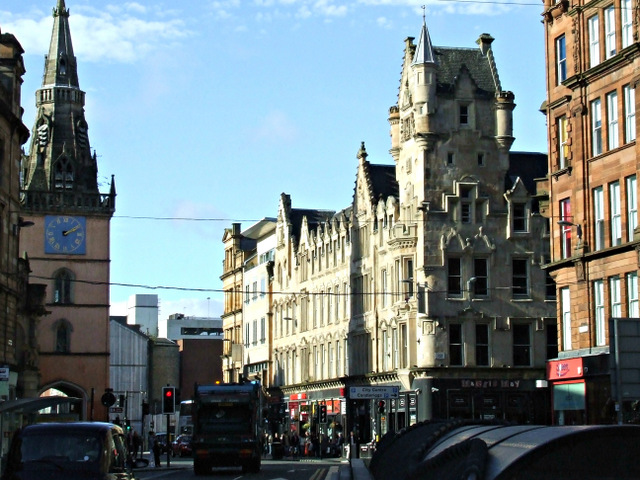
Image: © Thomas Nugent Taken: 5 Oct 2013
Looking west from Glasgow Cross, at the east end of Argyle Street. The white building in the centre is a Category A Listed http://data.historic-scotland.gov.uk/pls/htmldb/f?p=2200:15:0::::BUILDING:32782 former warehouse at the corner of Candleriggs. The Tron Steeple on the left is also Category A Listed http://data.historic-scotland.gov.uk/pls/htmldb/f?p=2200:15:0::::BUILDING:32769 .
Images are licensed for reuse under creativecommons.org/licenses/by-sa/2.0
Image Location
Latitude
55.856863
Longitude
-4.245236