Mains Water
Introduction
The photograph on this page of Mains Water by Martin Addison as part of the Geograph project.
The Geograph project started in 2005 with the aim of publishing, organising and preserving representative images for every square kilometre of Great Britain, Ireland and the Isle of Man.

There are currently over 7.5m images from over 14,400 individuals and you can help contribute to the project by visiting https://www.geograph.org.uk
Mains Water
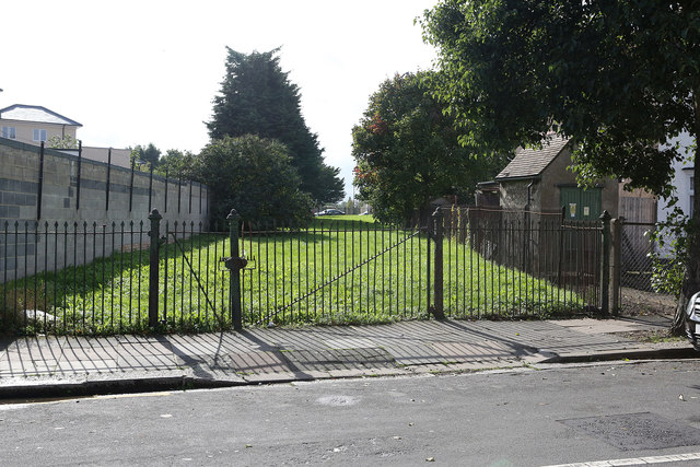
Image: © Martin Addison Taken: 4 Oct 2013
The rusted green posts and arrowhead wrought iron gates on a green avenue threading its way between houses are a giveaway that this in one of the Metropolitan Water Board's large mains. In fact this green avenue carries 42" and 48" mains connecting the water treatment works at Kempton Park with the pumping station at Cricklewood. The mains were broken by German Bombing on the evening of 30th September 1940 resulting in major water supply problems throughout northwest London. As recently as July 2013 the 48" main burst causing flooding to homes on Greenford Road not far from here.
Images are licensed for reuse under creativecommons.org/licenses/by-sa/2.0
Image Location
Latitude
51.519984
Longitude
-0.355439