
King's Lynn: South Gate and London Road
Introduction
The photograph on this page of King's Lynn: South Gate and London Road by John Sutton as part of the Geograph project.
The Geograph project started in 2005 with the aim of publishing, organising and preserving representative images for every square kilometre of Great Britain, Ireland and the Isle of Man.

There are currently over 7.5m images from over 14,400 individuals and you can help contribute to the project by visiting https://www.geograph.org.uk
King's Lynn: South Gate and London Road
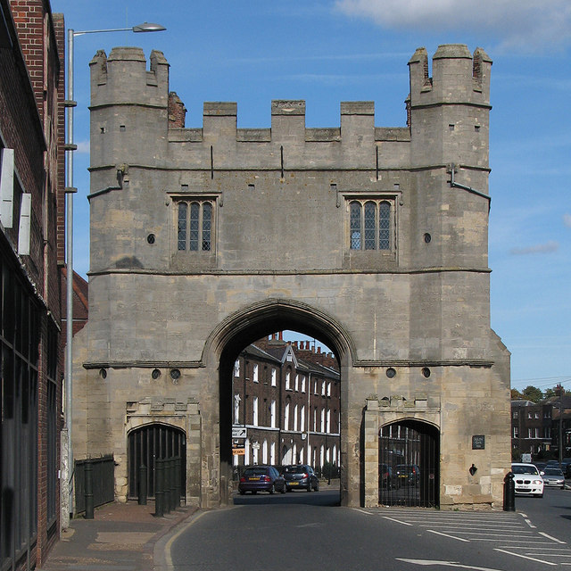
Image: © John Sutton Taken: 6 Oct 2013
Traffic entering the town from the south passes through the gate, but southbound traffic has passed it since London Road was widened in 1899. The Grade I listed gate tower is of red-brick and dates from the 15th century, but the ashlar face intended to impress visitors to Lynn was added in 1520. Nigel Mykura's Image] shows the north side.
Images are licensed for reuse under creativecommons.org/licenses/by-sa/2.0
Image Location

Latitude
52.745639
Longitude
0.401346