Wellington Court
Introduction
The photograph on this page of Wellington Court by Neil Owen as part of the Geograph project.
The Geograph project started in 2005 with the aim of publishing, organising and preserving representative images for every square kilometre of Great Britain, Ireland and the Isle of Man.

There are currently over 7.5m images from over 14,400 individuals and you can help contribute to the project by visiting https://www.geograph.org.uk
Wellington Court
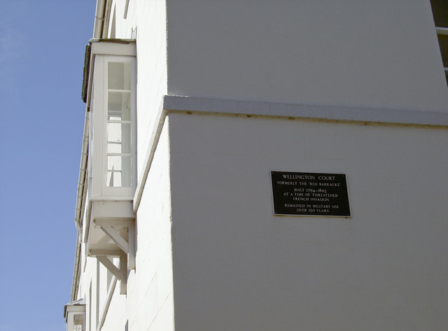
Image: © Neil Owen Taken: 2 Sep 2013
The area to the west of Nothe Fort used to be barracks for hundreds of soldiers. This block is now residential. See Image] for a suitably named pub nearby.
Images are licensed for reuse under creativecommons.org/licenses/by-sa/2.0
Image Location


Leaflet Map data © OpenStreetMap
Latitude
50.605794
Longitude
-2.45088