Rochester: 44 High Street
Introduction
The photograph on this page of Rochester: 44 High Street by Chris Downer as part of the Geograph project.
The Geograph project started in 2005 with the aim of publishing, organising and preserving representative images for every square kilometre of Great Britain, Ireland and the Isle of Man.

There are currently over 7.5m images from over 14,400 individuals and you can help contribute to the project by visiting https://www.geograph.org.uk
Rochester: 44 High Street
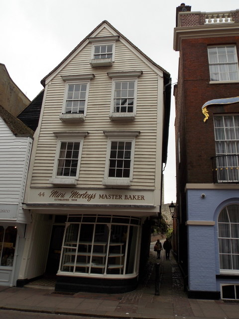
Image: © Chris Downer Taken: 29 Sep 2013
A listed building in both senses of the word, originating in the 16th century and leaning significantly towards its neighbour across Two Posts Alley. See Image for a close-up of the door and Image for a view from along the alley.
Images are licensed for reuse under creativecommons.org/licenses/by-sa/2.0
Image Location
Latitude
51.390137
Longitude
0.503043